
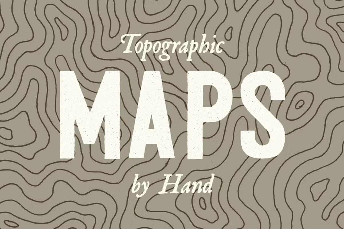
Introducing a Unique Set of Hand-Drawn Topographic and Elevation Maps
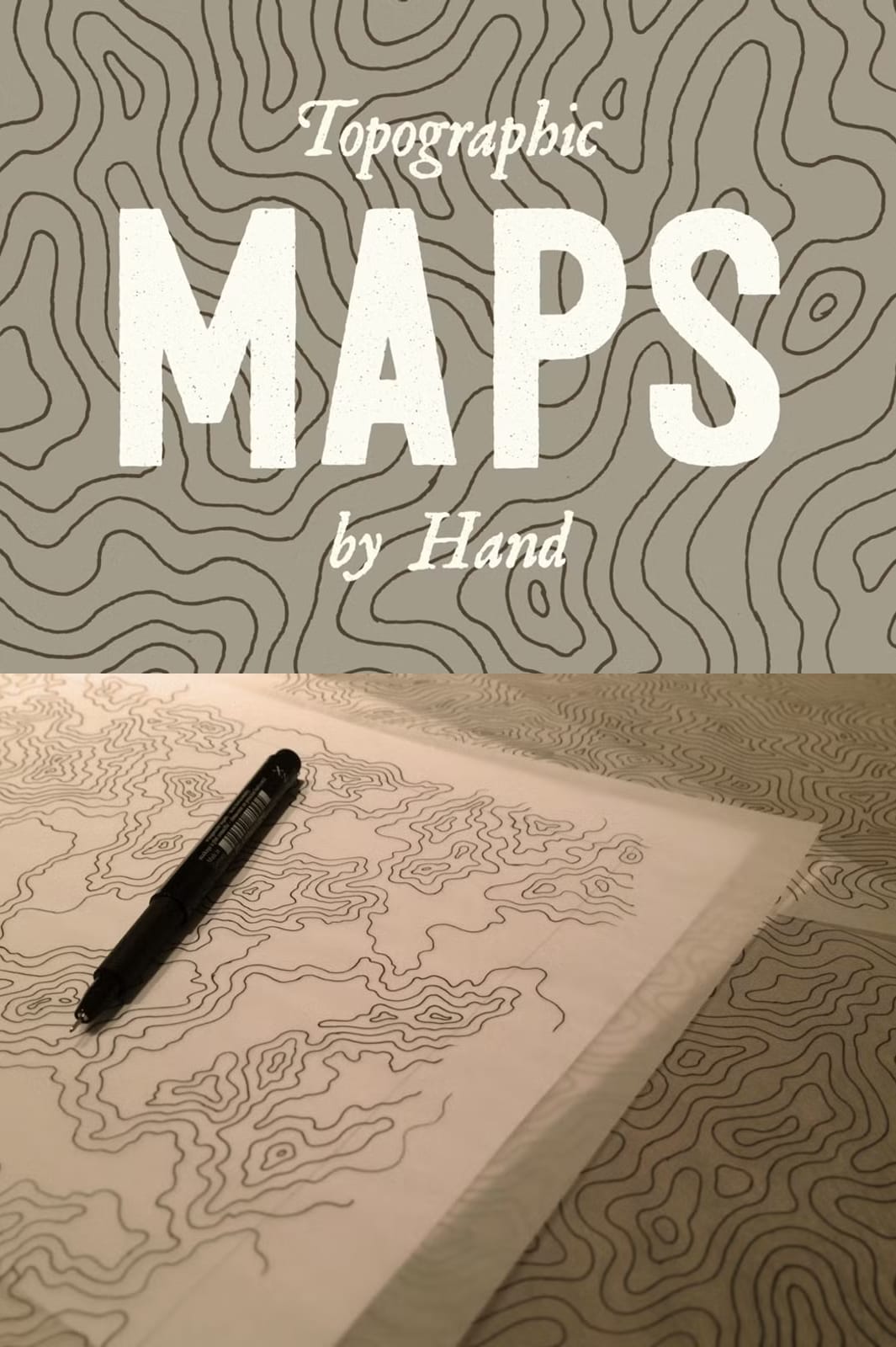
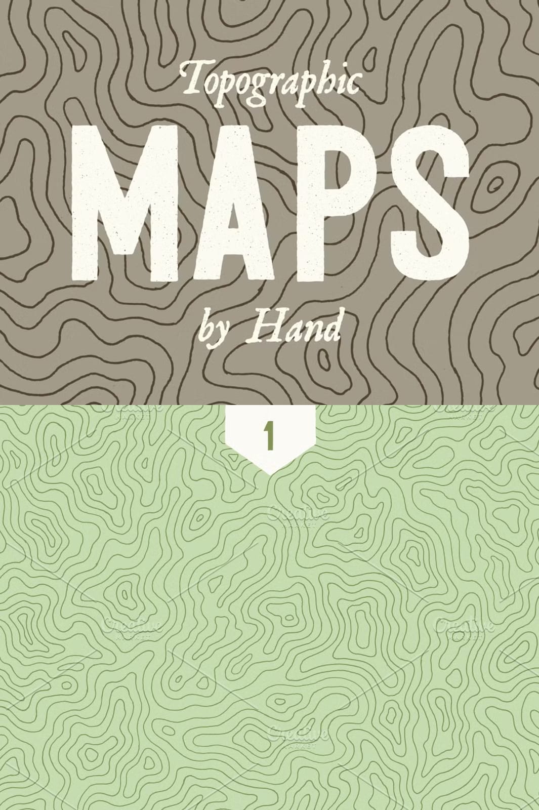
Discover a collection of three meticulously crafted topographic and elevation maps, each fully illustrated by hand to provide an authentic, organic aesthetic that digital recreations simply cannot match. These maps were carefully drawn with precision and artistic attention, embodying the subtleties and natural irregularities that only hand drawing can achieve. After completion, the illustrations were scanned and converted into high-resolution vector and raster files to ensure maximum usability and quality for a wide range of applications.
Premium Quality and Versatile File Formats for Design Flexibility
Each map is offered both as a vector EPS file sized at 8.5×11 inches and as a transparent PNG image boasting an impressive 8000×6100 pixel resolution—equivalent to 48 megapixels. These file formats and resolutions make it easy for professionals in graphic design, cartography, digital art, and creative industries to integrate the maps seamlessly into their projects. Whether you require scalable vector graphics for print or highly detailed raster images for digital display, these files cater to all your project specifications.
Organic Imperfections That Bring Authenticity and Charm
Unlike computer-generated maps, these illustrations maintain subtle imperfections from the hand-drawing process, lending each piece a unique character and depth. The organic line work showcases dark gray contour lines over a completely transparent background, offering excellent contrast and versatility for layering over other visuals or customizing with color adaptations. These artistic elements inject warmth and personality into your design projects, making your work stand out with genuine hand-crafted detail and sophistication.
Non-Tiling, Full-Page Illustrations Designed for Impact
Each topographic map in this set is a full-page illustration, designed at a scale large enough to highlight intricate elevation features and finely detailed contour lines. The textures do not tile or repeat, ensuring each image is a standalone work of art ready for impactful presentation in portfolios, editorial designs, environmental graphics, presentations, or any creative application where impressive geographic visuals are essential.
Time-Intensive Craftsmanship for Exceptional Quality
The creation of each map demanded approximately four hours of focused hand-drawing, exhibiting true craftsmanship and dedication to quality. This time investment shines through in every detail—from the careful line placement to the preservation of natural drawing strokes—offering users an invaluable resource that blends artistry with geographic precision.
Ideal for Professional and Creative Use Cases
Whether you are a designer seeking authentic elevation textures for branding projects, a digital artist looking to incorporate detailed geographic elements, or an educator developing visually compelling learning materials, this collection offers a versatile resource. The high resolution and variety of formats ensure compatibility with popular graphic software, supporting workflows in Adobe Illustrator, Photoshop, and other editing tools.
Download Your Set of 3 Hand-Illustrated Topographic Elevation Maps Now
Elevate your creative projects by integrating these high-quality, hand-drawn topographic maps designed to add depth, character, and an artistic touch to your work. Access this exclusive collection today and experience the rich detail and authentic look that only analog artistry can convey.


Leave a Comment